History
The First Colony Levee Improvement District (FCLID) was formed in 1982 “…to provide for the proper drainage and other improvements of reclaimed land within the District.” To accomplish this goal, a series of levees, ditches, and detention ponds were designed and constructed to provide flood protection against the 1% chance per year of flooding. This standard is set by the Federal Emergency Management Agency (FEMA).
FCLID protects approximately three square miles of residential and commercial property valued at over $1 billion. These properties consist of more than 8,500 residences, schools, and businesses in parts of Sugar Land and Missouri City. The levee is approximately 3.1 miles long.
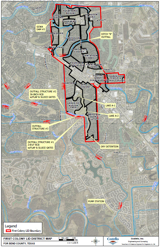
Neighborhoods within FCLID
South of State Highway 6
- Heritage Colony
- Lakes of Austin Park
- Lakefield
- Lake Colony
North of State Highway 6
- Oyster Creek Plantation, Sec. 1
- Plantation Trails at First Colony
- Plantation Park
- Magnolia Plantation
- Plantation Creek
- Plantation Colony
- Plantation Bend
- Lexington Colony
- Riverbend South
- Riverbend North
- Sugar Crossing
- Old Mill Park
- Creekshire
District Map
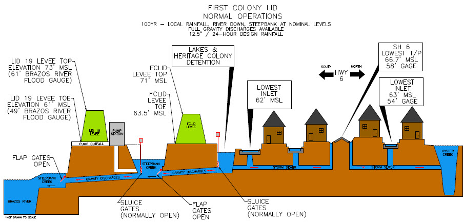
How Does Water Drain within the District
The cross section diagram below shows how the area within the District north of Highway 6 drains into Oyster Creek and the area within the District south of Highway 6 drains into Steepbank Creek. Steepbank Creek continues to flow through FBLID 19 and then into the Brazos River.